Bike navigation in Sofia: arriving safely, not just fast
In Sofia the shortest route is rarely the best one on a bike. Ordinary car navigation will send you down a busy boulevard because that's the "faster" way. On a bike, though, something else matters - arriving safely.
Why car navigation doesn't work on a bike
Car navigation optimises time on the main roads. It doesn't know where the bike lanes run, ignores the one-way streets that bikes may use, doesn't look at gradient or surface, and certainly doesn't know where there are potholes or cars parked on the bike lane.
What makes bike navigation different
Bike navigation thinks like a cyclist:
- Bike lanes and quiet streets instead of four-lane boulevards.
- Gradient - on a bike every climb is felt, so the route shows how steep it is.
- Surface - asphalt, cobbles or dirt path; a big difference for comfort and safety.
- Live hazard reports - potholes, dangerous junctions and broken surface, shared by other cyclists.
How Cycly picks the route
Cycly combines the OpenStreetMap map with the bike-lane layer from BAEM and offers several options, preferring the safer ones - along bike lanes, park paths and calm streets. For each route you see the time, the gradient, the surface and the weather before you set off.
Practical tips
- Plan the route before you leave, not at the junction.
- Check the gradient - sometimes a slightly longer but flatter route is more pleasant.
- At rush hour avoid the big boulevards even if they're more direct.
Live turn-by-turn navigation
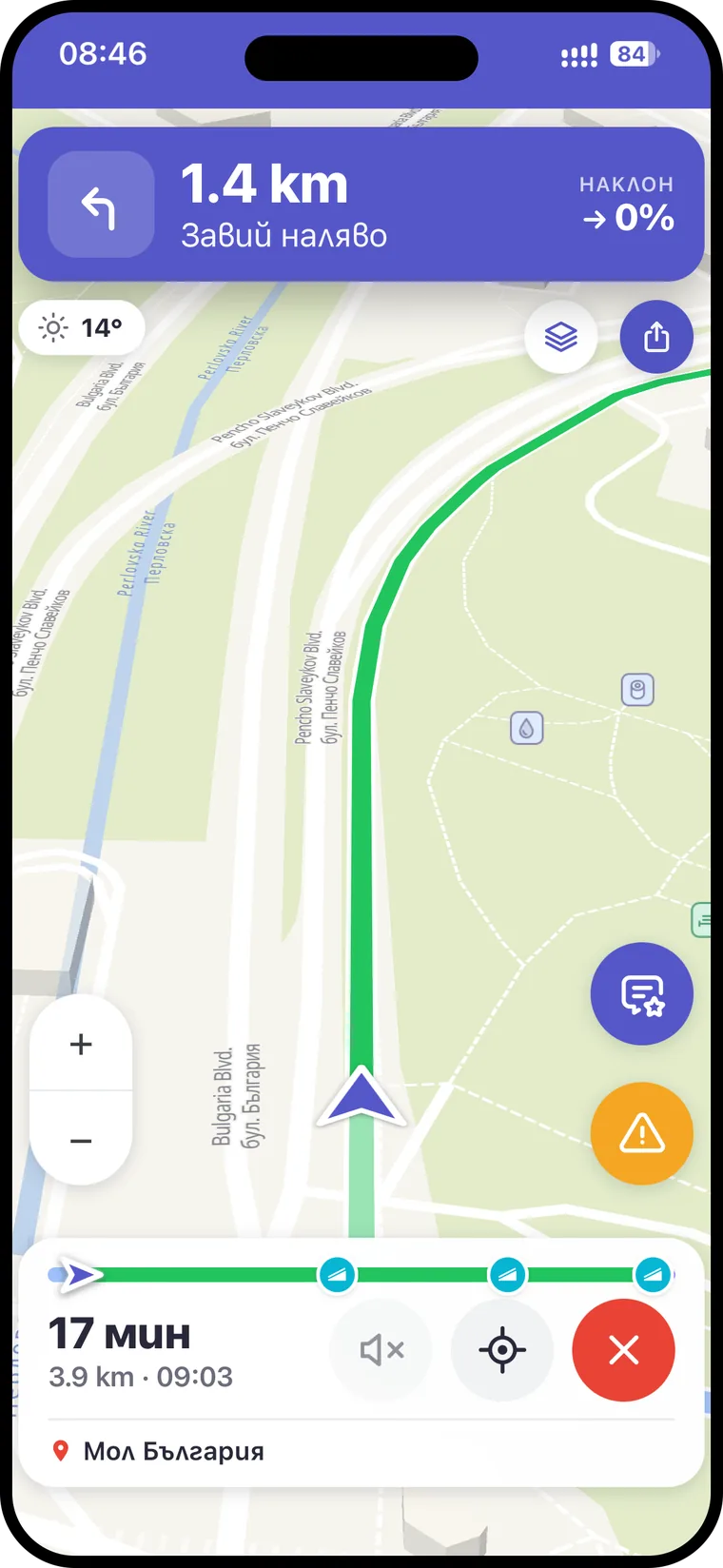
While you ride, Cycly guides you turn by turn with clear instructions and optional voice navigation, so you don't have to stare at your phone. If you go off route, it reroutes automatically and continues from where you are. Along the way it warns you in advance about reported hazards and about the spots where a bike lane ends and you rejoin the road.
Gradient matters in Sofia
Sofia isn't flat - towards Vitosha and the southern neighbourhoods the terrain climbs noticeably. So gradient isn't a small detail: sometimes a route with a turn or two more, but flatter, is faster and far more pleasant than the direct way uphill. Cycly shows the elevation profile so you can judge your effort before you set off.